NSLOG TEST - Meteosismi by IK8SUT
Menu principale:
| No Active Thunderstorms |
2/19/12
14:25:47 | ||||||||||||||||||||||||||||||||||||||||||||||
Peak Rate: 7/min
Time: 09:51:35 Peak Burst: 7/sec Time: 09:51:35
Last Strike
Time: 10:00:18 Distance: 329 Direction: 86.9° Type: -IC
Updated Last:
|
|||||||||||||||||||||||||||||||||||||||||||||||
|
|||||||||||||||||||||||||||||||||||||||||||||||
|
Strikes /min
|
|||||||||||||||||||||||||||||||||||||||||||||||
|
| |||||||||||||||||||||||||||||||||||||||||||||||
| Update Rate Map: Storms: Graph: | |||||||||||||||||||||||||||||||||||||||||||||||
| NSDisplay Design by nordicweather.net and Maintained by jcweather.us | |||||||||||||||||||||||||||||||||||||||||||||||
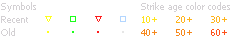


Map Legend
Nexstorm can identify the direction and type of lightning, and to some extent, the distance. Cloud to Ground is obviously much more dangerous than intracloud. Both show how much energy is in a storm cell. Take the distance information from this display with "a grain of salt" and consult Wasp2 below or The Strikestar network for more accurate ranging.
+CG Positive cloud to ground strike |
-CG Negative cloud to ground strike
+IG Positive intracloud strike | -IG Negative intracloud strike
+IG Positive intracloud strike | -IG Negative intracloud strike

|
Storm ID Key:
- or + indicates dominating strike polarity. 5 indicates last recorded strike rate. ^ - v indicates if storm is increasing, steady, or decreasing. |